Another First Alert Weather Day posted for dangerous cold, travel on Wednesday
BATON ROUGE, La. (WAFB) - In the wake of an historic snowstorm on Tuesday, we are posting another First Alert Weather Day for Wednesday as the focus shifts to dangerous cold and travel.
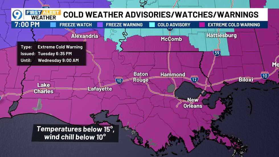
EXTREME COLD WARNING
An Extreme Cold Warning is posted area-wide through 9 AM on Wednesday. The warning is to cover the potential of temperatures dropping below 15 degrees and wind chill values in some areas reaching the single digits.
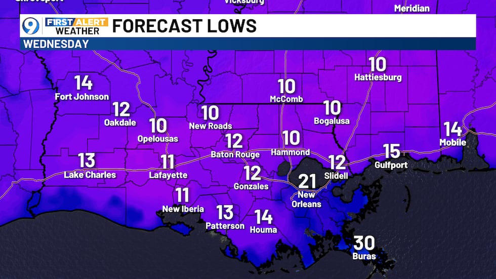
FORECAST LOWS
My forecast calls for widespread lows of 10°-15° across most of our area. The forecast low of 12° in Baton Rouge would not only shatter the daily record of 19° but would also be the coldest recorded at the airport since Christmas Eve 1989.
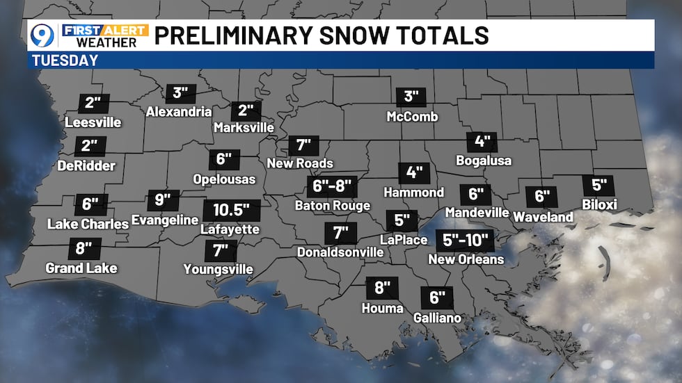
SNOW TOTALS
Suffice to say that Tuesday’s snowstorm was historic for our part of the world. Widespread totals of 4″-8″ were noted, with some reports of 8″-11″+. No official determination has been made for Baton Rouge at this point, but it appears likely to go down as our second biggest snow total on record, trailing only the 1895 storm.

EXTENDED OUTLOOK
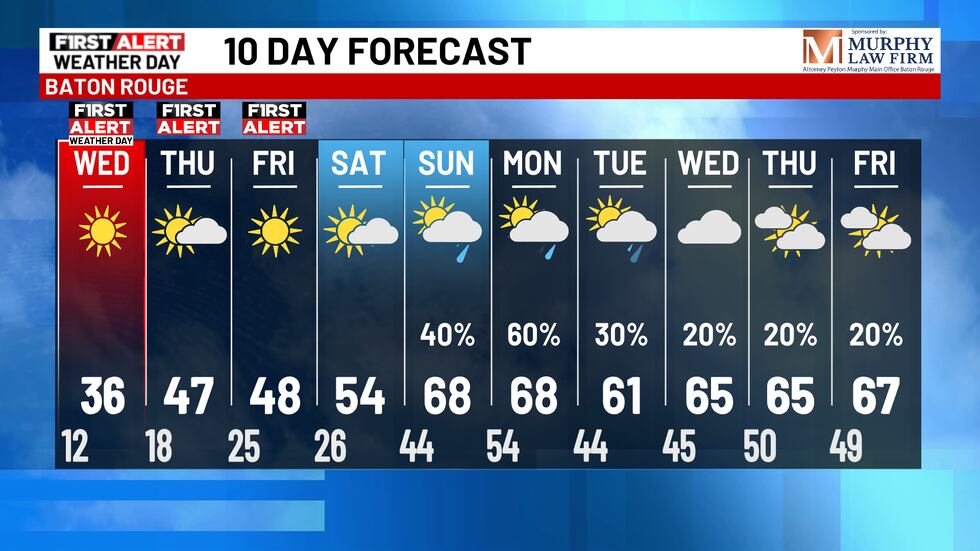
Another hard freeze is likely from Wednesday night into Thursday morning, meaning it’s quite possible that significant travel issues persist into Thursday. We will be cautiously optimistic that highs in the upper 40s on Thursday will be enough to start a more significant thaw before temperatures drop back below freezing that night. But big changes arrive by the weekend, with much warmer temperatures and good rain chances by Sunday and Monday.
Click here to report a typo. Please include the headline.
Click here to subscribe to our WAFB 9 News daily digest and breaking news alerts delivered straight to your email inbox.
Copyright 2025 WAFB. All rights reserved.